


A giant colouring wall map of the South Downs National Park
We loved working with the South Downs National Park Authority again on our 5th colouring mural commission for them!
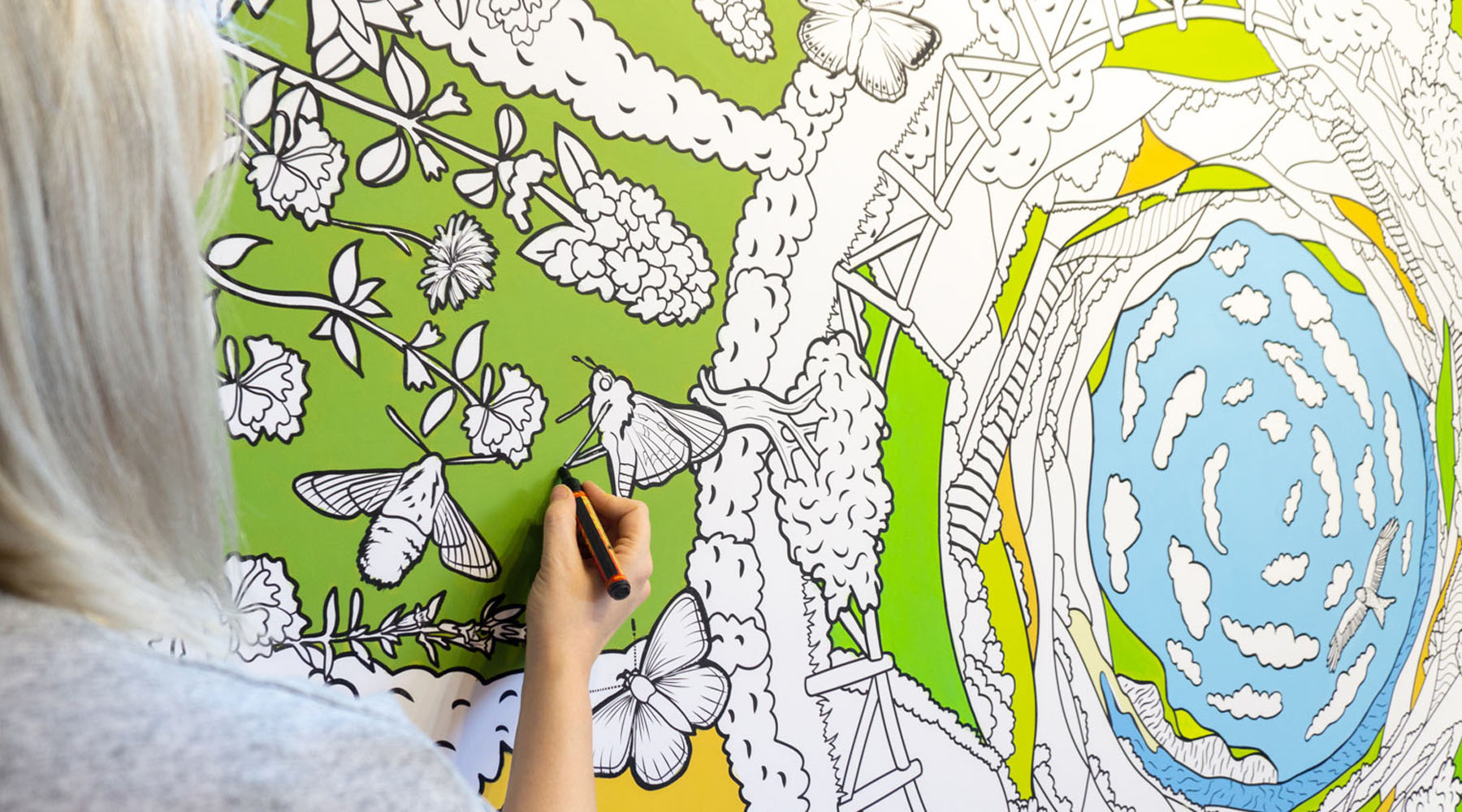
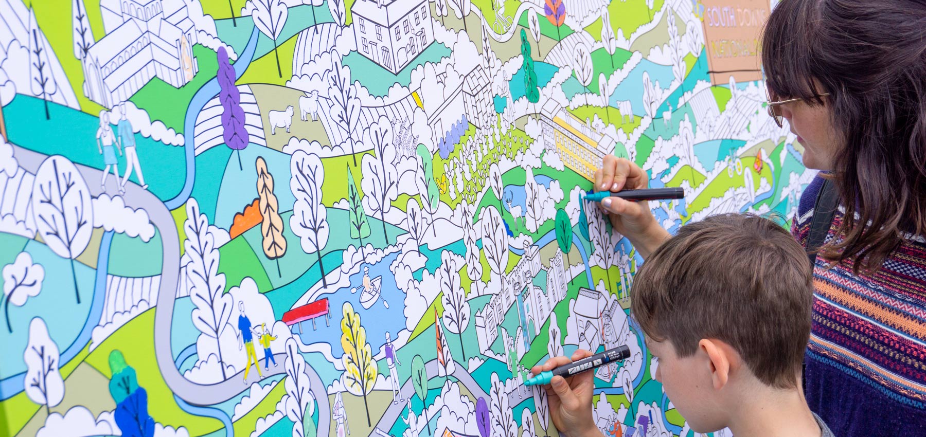
We illustrated this map of the South Downs National Park and reproduced it into multiple giant murals that were coloured by the public at events throughout 2019.
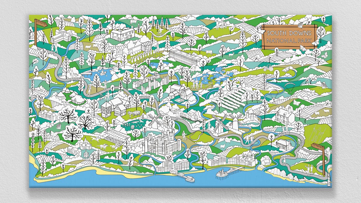
The 3D map is illustrated with the chalk hills typical of the South Downs with the Clay Hills of the Western Weald.
The buildings and landmarks are drawn in a loose isometric style, whilst the twisting boughs of the trees are layered above their foliage, a style influenced by mid-century Scandinavian art.
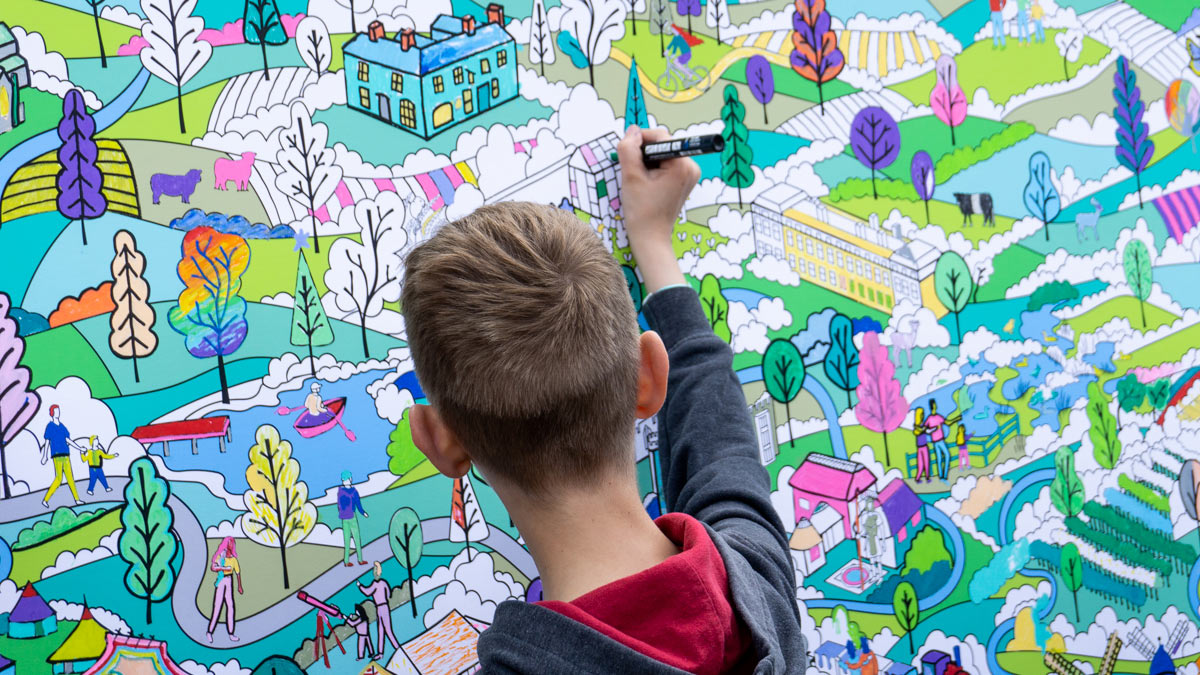
The map shows the paths of the six key rivers that meander through the park, Cuckmere, Ouse, Rother, Adur, Meon and Itchen. You can also see the path of The South Downs Way, the only National Trail that lies completely within a national park, spanning its entire length.
As we look ahead to our tenth anniversary, we reflect on some of our recent achievements:
— South Downs National Park (@sdnpa) September 25, 2019
✅ Refurbishing the South Downs Way 🏞️
✅ Creating more habitats to support wildlife 🌳🦋
✅ Record engagement with young people 👥
See what else we achieved 👉 https://t.co/m387ZlsBU4 pic.twitter.com/sPH5pOnW6v